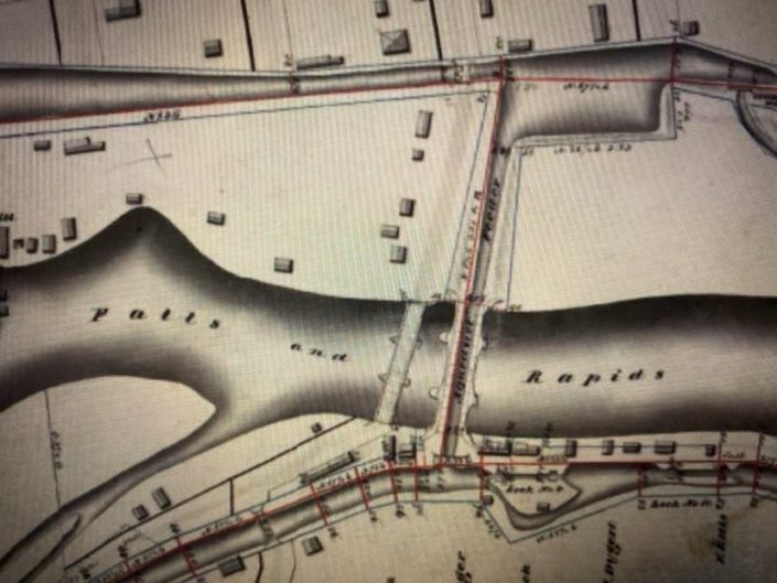
1822 AQUEDUCT | A BRIDGE FOR BOATS
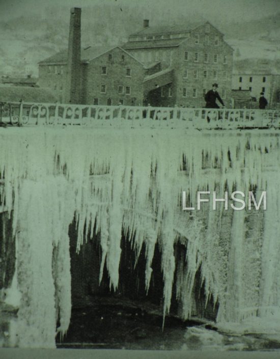
From the Cooney Archives: “On December 1, 1853, John Burnham was attempted to cross the aqueduct on the side without rails, slipped on the ice, and fell 20 or 25 feet to his death upon the rocks below.”
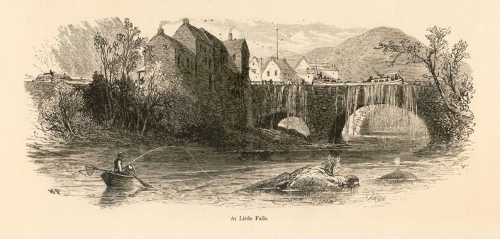
The Erie Canal was designed to avoid natural bodies of water, with eighteen aqueducts being built over rivers to reach canal villages for trade and transportation. The proposed route of the Erie Canal would be south of the Mohawk River at Little Falls and therefore would bypass the city completely. This ensued the merchants to lobby for a water connection to their businesses, which resulted in the construction of the 1822 Aqueduct.
The Village of Little Falls was resettled after the American Revolution by a wealthy British fur trader, Alexander Ellice, who had purchased the 1,200 acres of which the village consisted of. Ellice held title to all the land at Little Falls and charged high rents for its use. The Ellice Estate gave the land and building stone necessary to construct the bridge for boats, the 1822 Aqueduct, and the boat basin.
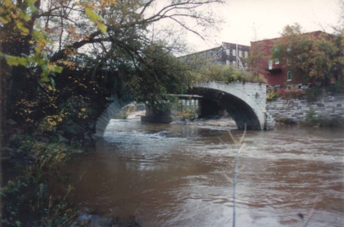
1822 Aqueduct spanned the Mohawk River
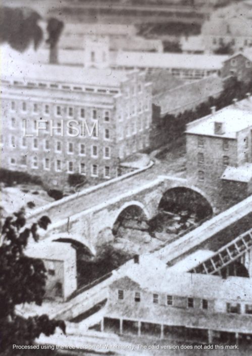
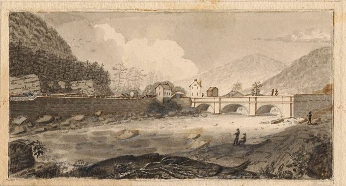
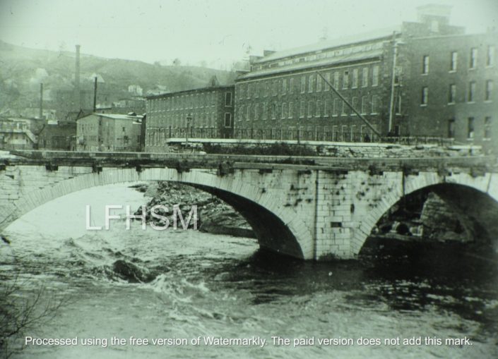
The 1822 Aqueduct spanned the Mohawk River, allowing boat traffic on the Erie Canal to enter the Little Falls Harbor Basin and also allowed canal boats a connection with the 1795 Western Inland Lock Navigation Canal. The Aqueduct connected the mills, with materials for manufacturing and shipping of products, along the north side of the Mohawk River with the Erie Canal.
This amazing structure was built of hand-cut limestone by a stone mason from Utica, Ara Broadwell, who built this structure in 8 weeks. He also built canal locks, culverts, and other aqueducts along the Erie Canal. He received a payment of $45,532.50 from the State of New York in 1822, for the building of the Little Falls Aqueduct and seven locks above the falls of the cascading rapids.
The Little Falls Aqueduct consisted of three arches. The middle arch spanned 70 feet across the Mohawk River, with the two side arches each spanning 50 feet. The arches supported two 4.5 feet high side walls, with the waterway being 16 feet wide and 214 feet in length. The towpath for the Aqueduct was made from wood.
A marble slab plaque was attached on the middle arch, which was inscribed by Erastus Cross in 1822, and read as follows:
Erected in 1822: Commenced Aug.23 – Completed Oct.15
Canal Commissioners:
DE WITT CLINTON, President
STEPHEN VAN RENSSELAER, SAMUEL YOUNG, HENRY SEYMOR, MYRON HOLLEY, WILLIAM C. BOUCK
HENRY SEYMOUR, acting commissioner, BENJAMIN WRIGHT, chief engineer, CANVASS WHITE, assistant, and ARA ROADWELL, builder.
The Little Falls 1822 Aqueduct was the only aqueduct along the Erie Canal that was never altered during the enlargements of the canal.
According to the Cooney Archives: THIS DAY IN HISTORY …” On April 27, 1883, the Aqueduct crossing the river has been declared unsafe, and signboards were erected at each end forbidding persons from crossing it.”
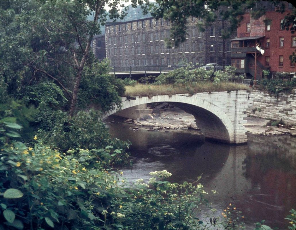
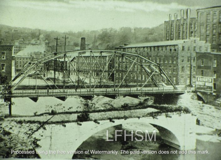
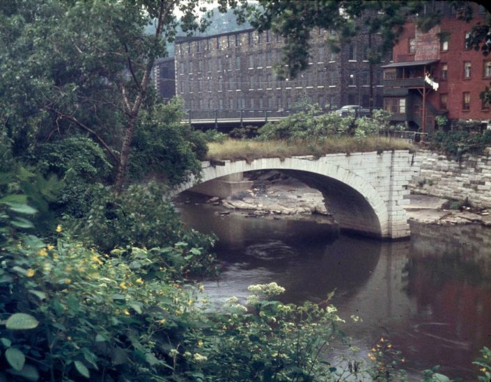
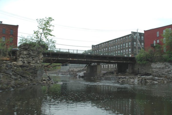
The Aqueduct remained in service until June of 1881, when one side burst open, which it was then drained. By December of 1881, the Canal Commission had abandoned the Aqueduct and feeder canal and offered them up for sale. The Aqueduct’s north arch was demolished in 1891 for factory expansion and the south arch fell in 1928. Flood waters in 1993 took down the central arches. A few stones remain at the base on the southern side of the Aqueduct that can be seen from the right side of the Ann St Bridge to Benton’s Landing.
According to the Cooney Archives: THIS DAY IN HISTORY …” On November 11, 1993, the center span of the Little Falls Aqueduct stood for 171 years; it finally collapsed late this evening. It had been more than a century since the last maintenance was conducted on it, a testimony of both the fitness of the original design and the skill of the workmen who built it. The aqueduct was built in 1822 as a feeder from the Western Inland Lock Navigation Canal.”
LITTLE FALLS HARBOR BOAT BASIN
The boat basin, known as Little Falls Harbor Boat Basin, was built into the Western Inland Lock Navigation Canal. To the west of the harbor, the WILNC was used first as a canal feeder and in 1836 the feeder was converted into a raceway for industries by Arphaxed Loomis, who also had built a stone dam on the river to harness the Mohawk River for waterpower for industries along West Mill Street.
The village received in 1883, a deed to the Little Falls Harbor Basin, which up to this time, was held by Arpahxed Loomis, the first judge of Herkimer County. Land divisions had set the eastern boundaries for Herkimer County in 1791, which up until this point in time, the south side of the village was in Montgomery County.
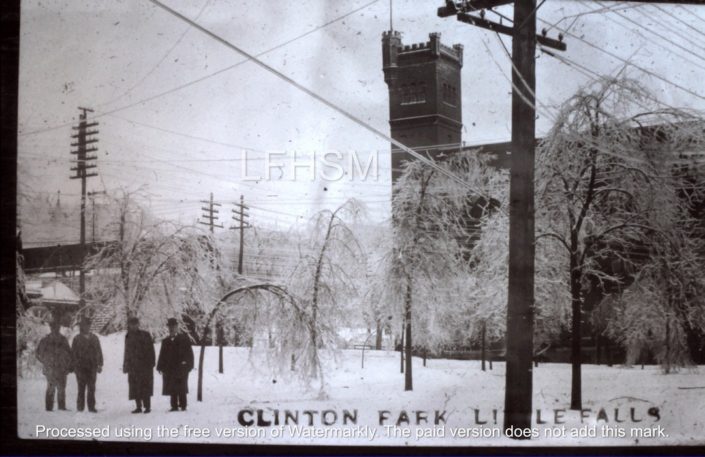
According to the Cooney Archives: THIS DAY IN HISTORY …” On May 2, 1883, the State sold the basin, bounded by South Ann and East Mill streets, (Clinton Park) to the village for one dollar. The basin had used the Inland Canal as a feeder and was connected to the Erie Canal via the Aqueduct so boats could satisfy the needs of the “North-Side” merchants. The old Inland Canal was gradually filled in. The people continued to use what was once the basin as a dump.”
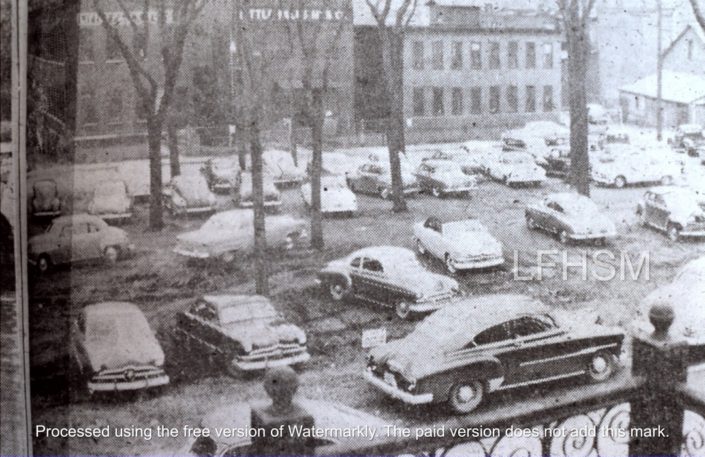
Once filled in, the Little Falls Harbor Boat Basin area then became Clinton Park, which years later became a municipal parking lot. The lot eventually became the present-day location of Showcase Antiques of CNY.
*Digitizing of Historical Photos by Gail & Mike Potter, FROM THE COONEY ARCHIVES: THIS DAY IN HISTORY by Louis Baum, JR, and article written by Darlene Smith
Be sure to visit the Little Falls Historical Society Museum’s Little Falls Waterways virtual exhibit.
The Little Falls Historical Society’s Old Bank Building Museum is open by appointment only for the winter season. For a FREE tour of the museum, please contact either Louis Baum @ 315-823-3527, Mary Ann Terzi @ 315-823-1502, or Jeffery Gressler @ 315-823-2799 to schedule an appointment.

